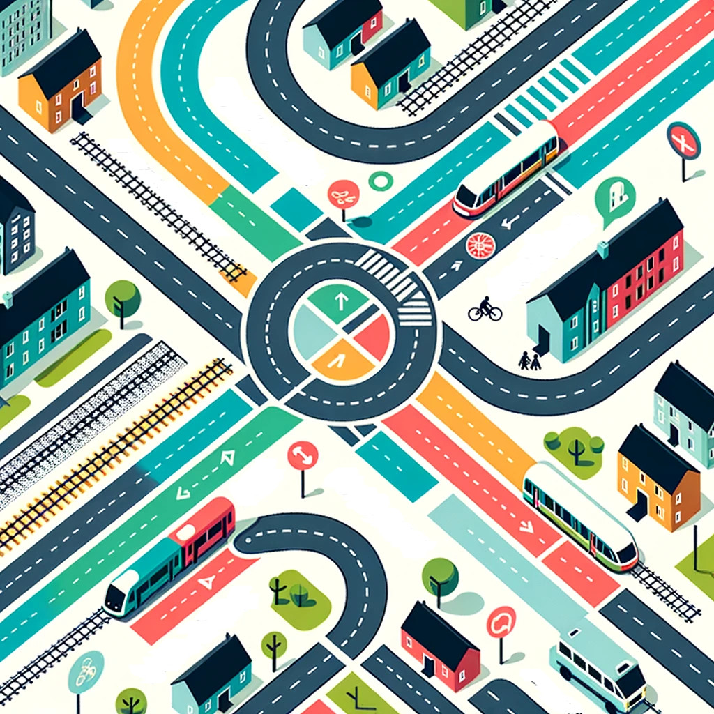
A Holistic Approach to Transport in Ballina
Forward and Summary of Proposals
In the evolving landscape of urban planning, addressing traffic congestion and infrastructural challenges requires more than just laying down asphalt. A holistic solution for transport in Ballina will require an orbital road, not as a solitary plea for another stretch of tarmac, but a strategic component of a comprehensive vision.
This vision champions not only the facilitation of smoother transport but also emphasizes the integration of sustainable, community-agreed solutions. We advocate for an approach that views the Ballina Orbital Road as one pivotal piece in a multi-faceted puzzle aimed at revitalizing, connecting, and future-proofing the town for generations to come.
Ballina is a compact, beautiful, historical town situated in an enviable topology with a dependent population of about 40,000 people. Its transport system has great potential but requires some alterations to function correctly, the majority of which can be carried out by Mayo County Council in the short term, namely:
- Complete Bypass Road: Build missing Crossmolina-Killala and Enniscrone-Foxford sections as regional road.
- Cycling: Better cycling paths, fill in missing links in urban network per Cian Ginty’s plan.
- Bus: Implement a minibus network by expanding existing local link service.
- Green Spaces: Convert carparks into green, social spaces while preserving minimum necessary car-parking.
- Rail: Ballina-Foxford service is already very good, but can be improved with the agreement of Iarnród Eireann.
- Safety: Alter current inner traffic system to ensure safety of pedestrians, cyclists and motorists alike.
- River: Bridge river from Belleek to Quay using footbridge or ferry, restore access from the town centre.
- Connect: Ensure all modes connect, park and ride to bus, bus to train, bikes carried on buses and trains.
The current Government has repeatedly called for infrastucture proposals that favour bypass roads and multi-modal green solutions. We present this holistic vision for Ballina in this spirit, as an exemplar of how to address transport challenges in a manner that enhances liveability, sustainability and community well-being for decades to come.
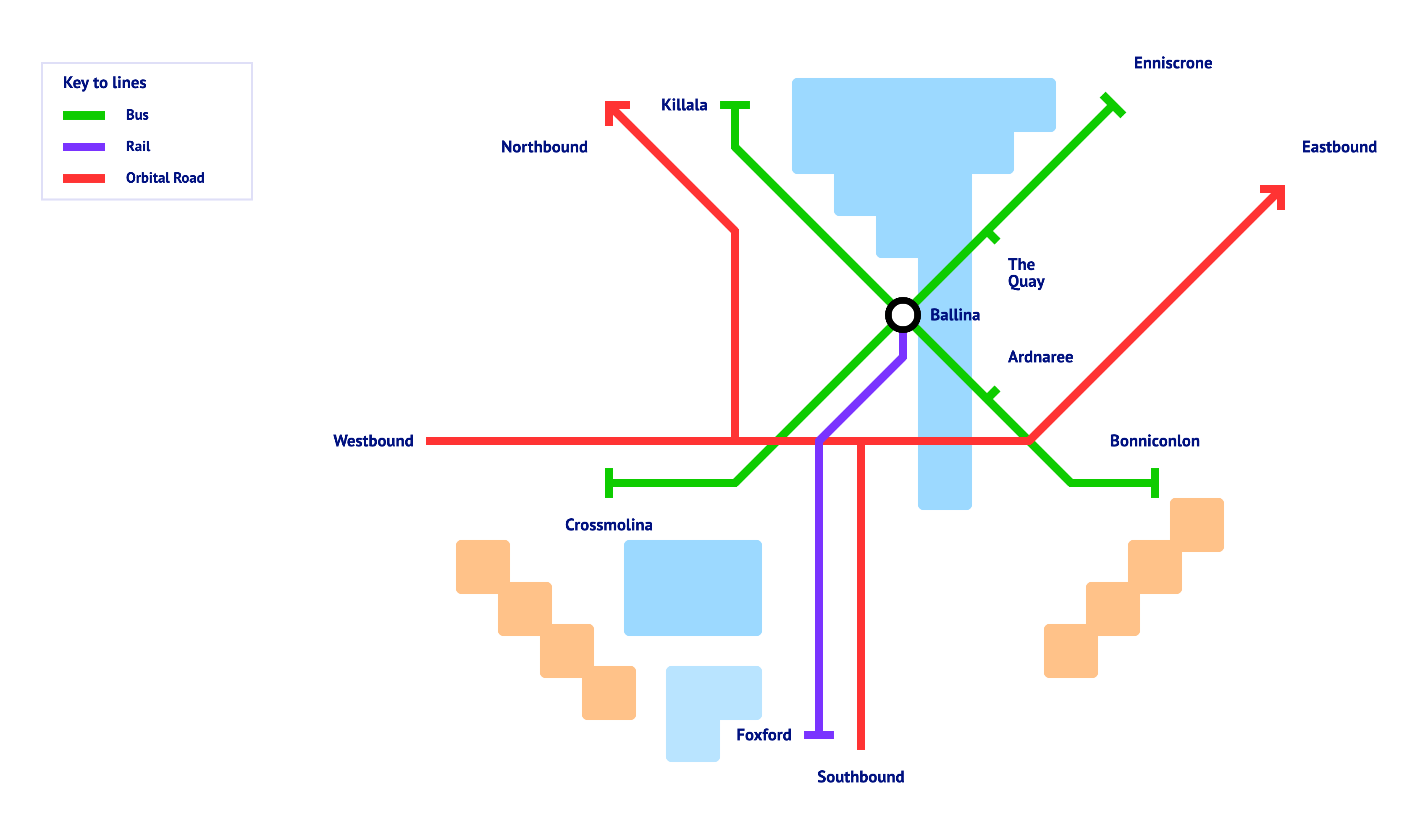
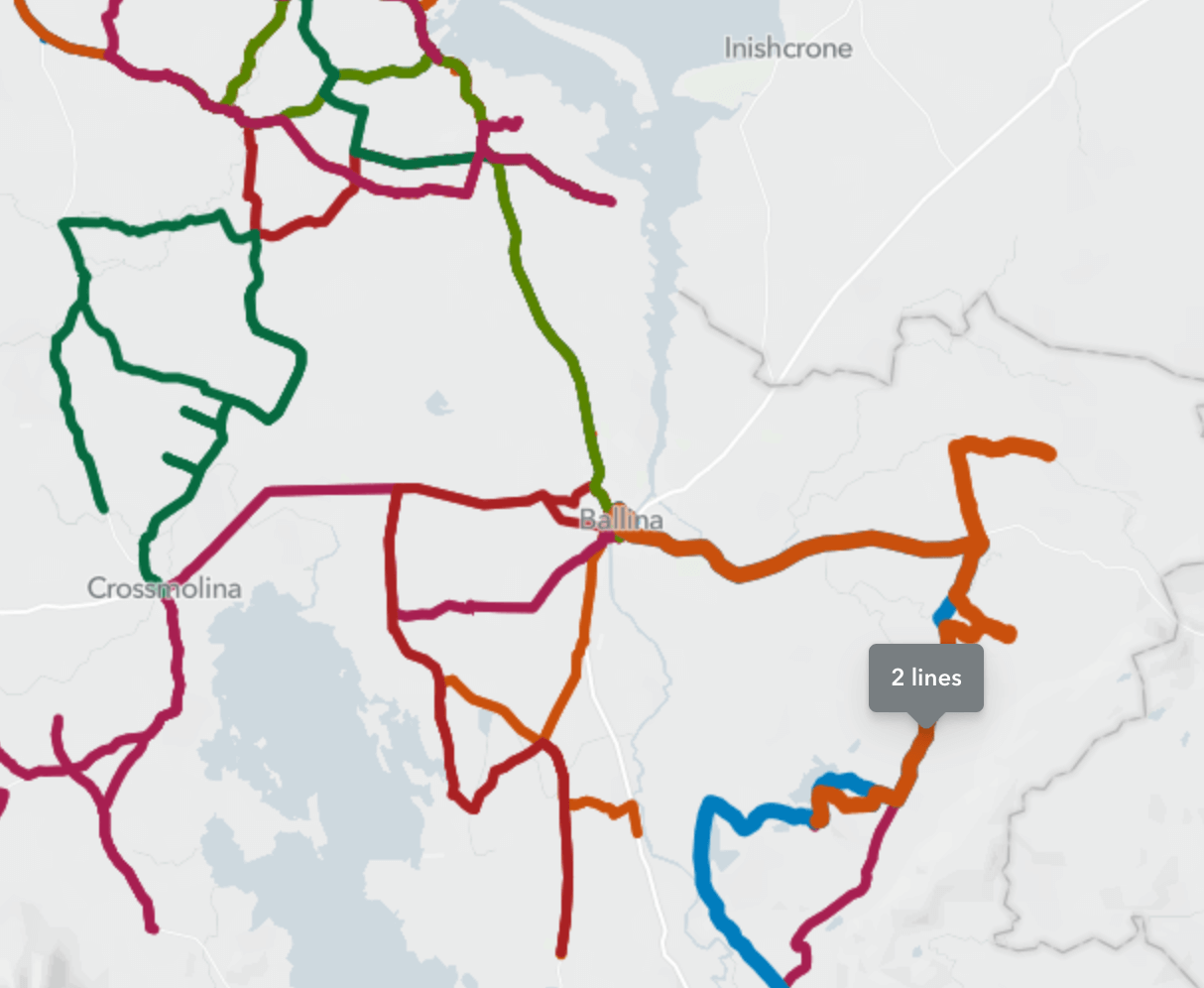
Holistic transit map for Ballina and surrounds
A complimentary cycling and walking map.

Policy Changes, Opportunities, and Ballina’s Strategic Position
In light of recent Government policy shifts, there has been a notable pivot towards prioritizing urban bypass roads over traditional motorways. This change is not just a matter of infrastructural preference but signifies a broader vision of connectivity and urban development.
Ballina finds itself at a unique juncture with this policy change. The Minister for Transport has actively been seeking submissions, suggesting there is significant opportunity for Ballina to secure funding for a bypass in the imminent budget allocation. This is not just about constructing another route; it is about envisioning a multi-modal and holistic approach to transportation, emphasizing a comprehensive plan rather than merely building ‘just a road’.
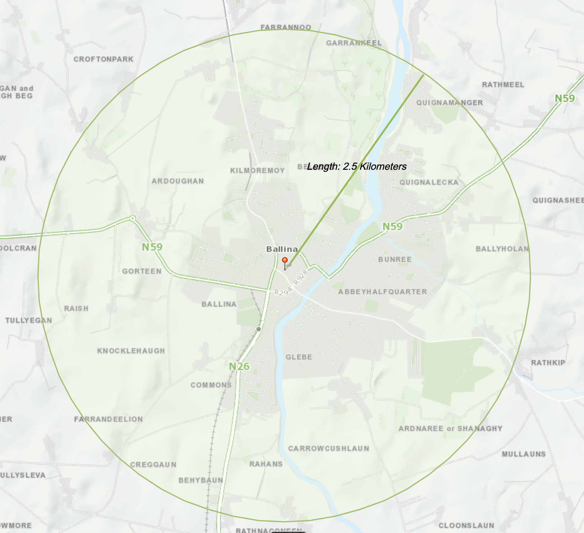
Geographically, Ballina’s landscape is diverse, interconnected and most importantly, compact. The main urban expanse spans roughly a 2.5km radius and contains the major employment centres, schools, housing and commercial estates.
2.5 km is a 30 minute walk or 10 minute bike ride for most people
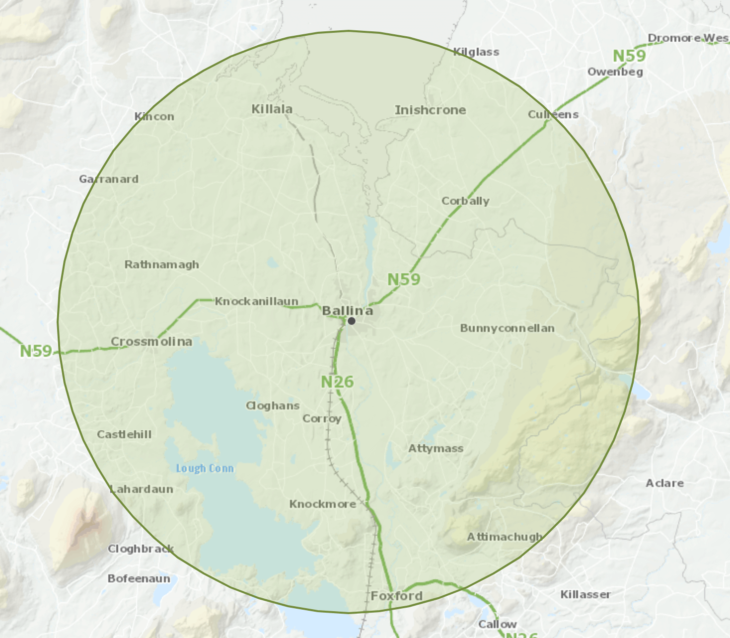
Surrounding this central hub are smaller towns that naturally gravitate towards Ballina for employment and services, namely Killala, Crossmolina, Foxford, Enniscrone, and Bonniconlon. The traffic is not all one-way these smaller towns play crucial roles in the broader urban tapestry, contributing to the socio-economic vitality of the region via natural attractions such as beaches, mountains, lakes, rivers and other leisure facilities.
In terms of population demographics, the Municipal District on Ballina’s western shore, known as Ballina MD, recorded a population of 32,688 in 2016. Conversely, the eastern shore, designated as the Ballymote - Tobercurry MD, registered 26,731 residents in the same year. Factoring in the 5.7% growth noted in the 2022 Mayo census, the current population for the region is estimated to be between 40,000 and 45,000 individuals. This population size and the accelerating growth rate, underscores the importance of robust and forward-thinking infrastructure planning, ensuring that the needs of the residents are met effectively.
In the context of recent policy changes, towns like Ballina have been presented with an opportunity to reimagine their urban and transportation landscape. With a holistic and multi-modal approach at its core, the town can leverage recent momentum to foster sustainable and inclusive growth.
Green Spaces and Urban Areas
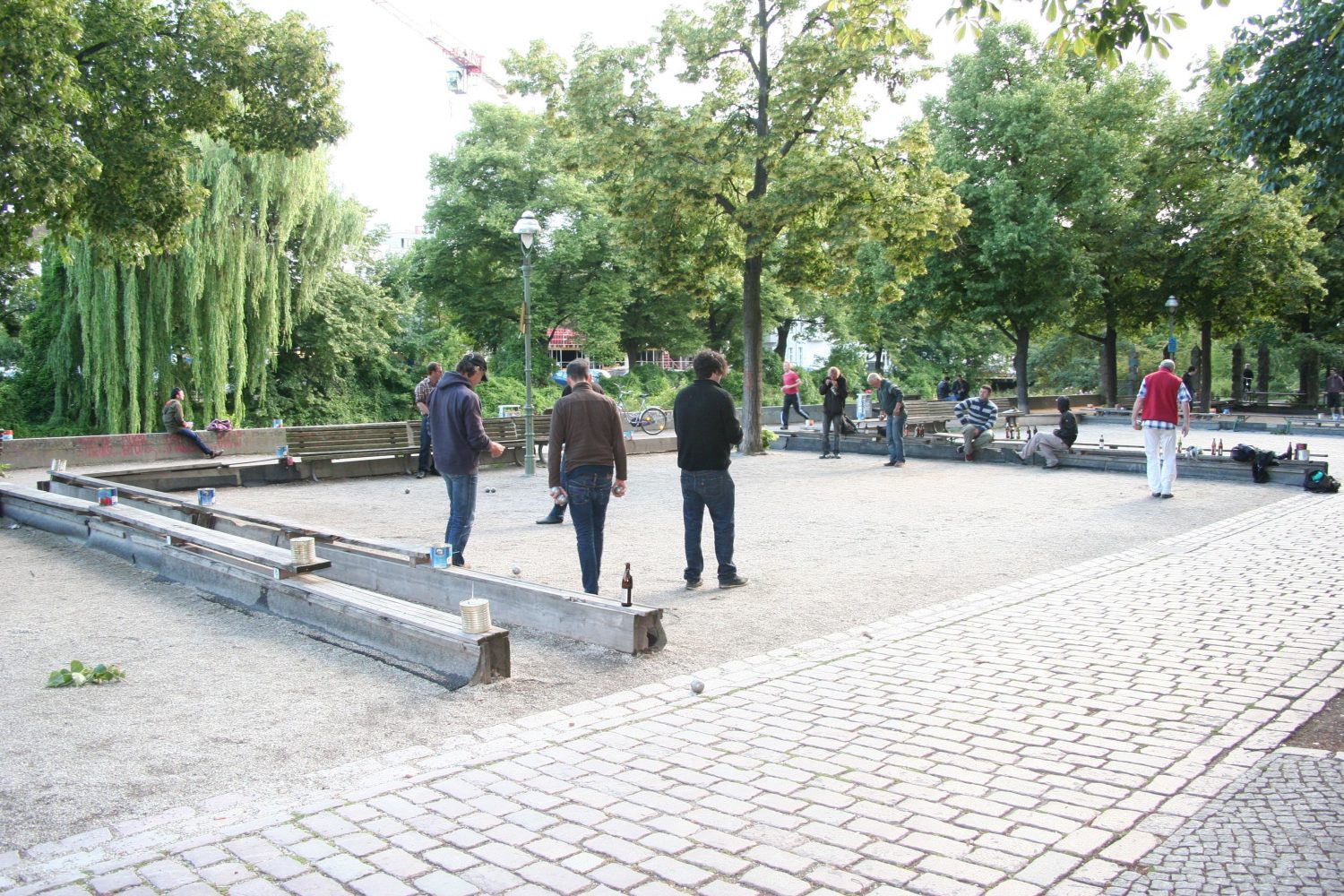
The heart of a town is often reflected in the spaces it provides for its residents to come together, relax, and connect. While Ballina is home to a rich tapestry of urban elements, there’s a noticeable absence of a central green space, like the Mall in Castlebar for example. Such spaces don’t merely offer an oasis amid the urban sprawl; they significantly contribute to the character and quality of life within a town.
The beautiful Castlebar mall
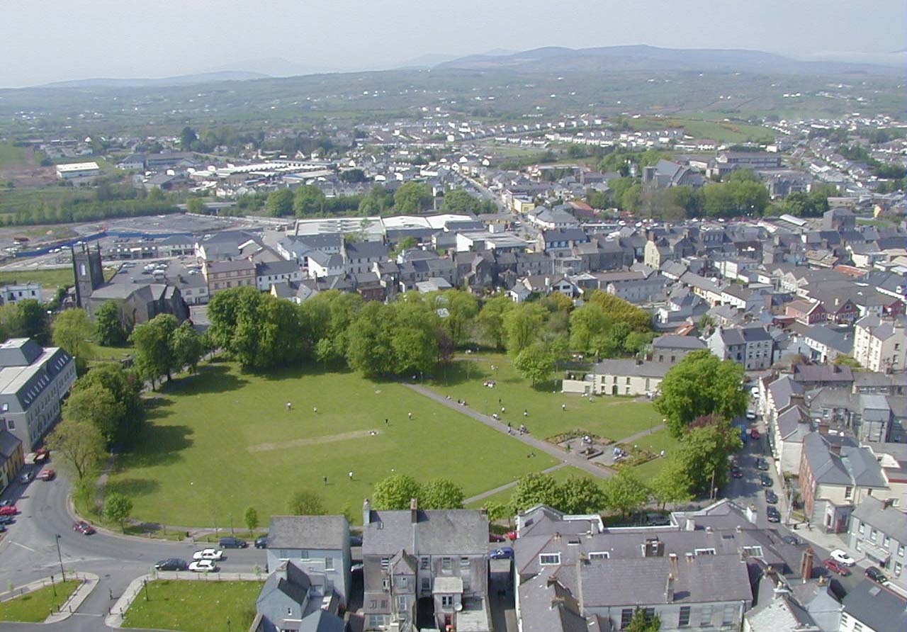
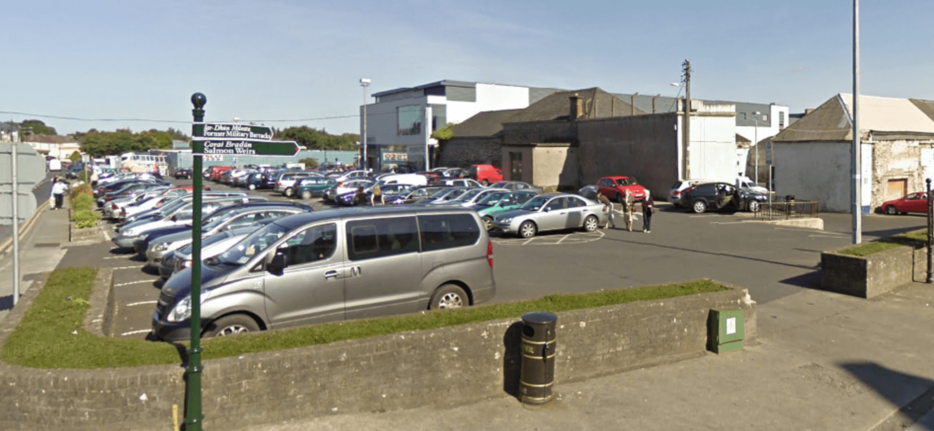
Ballina lacks a central green area, urban spaces are used as car parks
Historically, there have been consistent calls in successive reports for the introduction of such a green space in Ballina. Globally, desirable urban locales often boast of charming small parks that enhance their visual appeal and functionality. They often feature elements such as fountains, statues, well-tended lawns, and carefully curated plantings and more recently urban gardens and re-wilded spaces.
The Viktoria Luise Platz, an exemplary ornamental small park

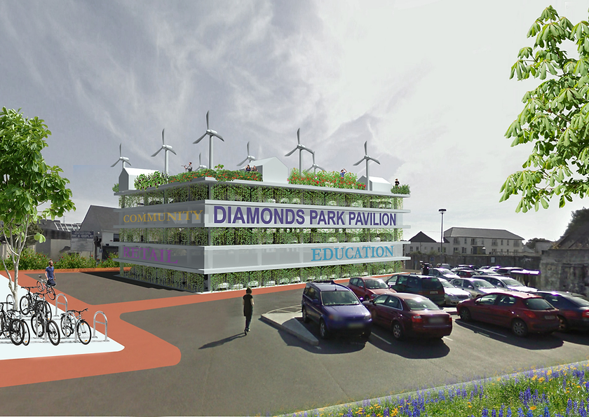
One pragmatic approach to achieving this vision in Ballina is to reconsider our current infrastructure, particularly our parking spaces. The Green Town Initiative presents a thought-provoking concept: a modular multistory park with a green wall. Such a structure could significantly reduce the footprint of surface parking, simultaneously enhancing the town’s green coverage. Not only does this represent a more efficient use of space, but the introduction of green walls also offers aesthetic and environmental advantages.
Reimagining the materials used in our urban infrastructure is equally crucial. With modern permeable materials like Grasscrete (recently installed in Farmleigh), it’s possible to marry the functionality of traditional surfaces with the sustainability and aesthetics of green alternatives. Such materials can effectively manage stormwater runoff while providing the aesthetic benefits of green spaces.

Innovative transformations don’t stop at parking. Smaller urban carparks hold the potential to metamorphose into vibrant hubs of community activity, such as skateparks, sports arenas, recreation zones, and playgrounds. By offering these recreational spaces, we not only elevate the aesthetic appeal of the area but also foster a culture where residents, both young and old, can congregate, engage, and enjoy outdoor activities.
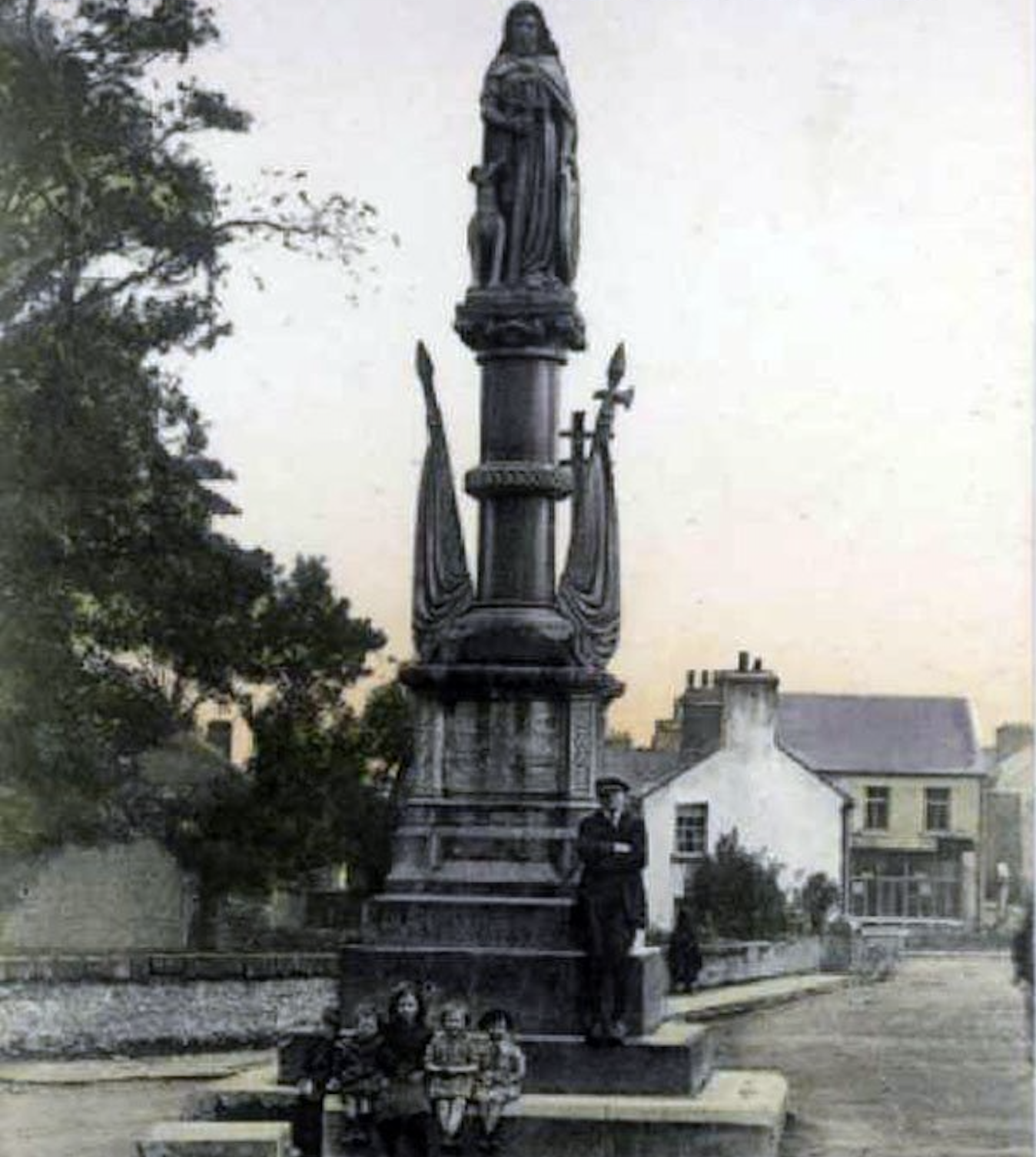
The transformation of the town’s function to accommodate the needs of private vehicular traffic has left some of its most interesting urban attractions detached and removed from their original context.
The Humbert monument once the centerpiece of the northerly gateway to the historic town centre has been exiled to an unlovely spot adjacent to a carpark, dominated by a supermarket at its back.
The market square is grey and bleak while Ballina’s only civic fountain, known colloquially as “the font”, has become peripheral over time and is now dominated by traffic at a busy junction.

A Rapprochement:
In essence, the vision for Ballina’s urban areas is clear: a harmonious blend of functionality and beauty, of innovation and restoration. The fundamentals of a beautiful urban space have not been lost but merely obfuscated. Through careful planning and innovative thinking, Ballina can build on these strong fundamentals gifted by natural topography and the ingenuity and vision of past generations, and embrace a greener, more sustainable, and community-centric future.
Walking and Cycling
As urban centres evolve, there’s a growing emphasis on creating accessible, safe, and sustainable mobility options for residents. In this regard, walking and cycling not only present eco-friendly alternatives but also enhance the physical and mental wellbeing of the community. In Ballina, the potential for developing expansive cycling thoroughfares and pedestrian walkways is significant, and several initiatives are shining a spotlight on this potential.
Cycling:
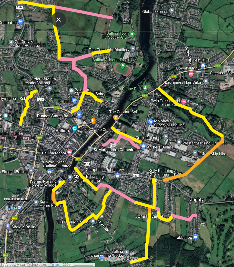
Cian Ginty, a cycling journalist activist from Ballina, has crafted a cycling and pedestrian route plan for the town that envisions an interconnected network that joins key neighbourhoods together. The plan integrates bridges where required and shows the possibilities that lie ahead for Ballina in the realm of sustainable transportation.
An illustration of new pedestrian and cycling bridge over the moy from the Ireland’s greenest town project

The main recommendations from the survey are:
- Reclassification of routes in relation to CycleConnects, particularly those linking to high employment, schools, and housing estates.
- Consider Alternative routes such as lower-traffic rural roads, when segregation is not always the preferred option.
- Extend Cycle Network beyond urban boundaries to reach housing clusters, villages, and other areas.
- New Walking and Cycling Bridge over the River Moy, connecting areas like Killala Road, Belleek Woods, Quignalecka and the Quay. Beneficial for transportation, tourism, and health.
- Better connectivity between various areas of Ballina, including schools, residential areas, sports clubs, and workplaces.
- Explore Potential Links that are not currently shown on the CycleConnects network map.
- Continue the route along the riverbank in the direction of Foxford to reach housing estates, Hollister and a nearby school
A schematic impression of Ginty’s proposals for Ballina and environs.
Ginty’s town centre map. Pink paths don’t exist currently.
Entertainment, leisure and culture clusters:
Although Ballina is compact geographically, the cultural and entertainment clusters in the town are not well connected, making complimentary mobility between them difficult.
- Belleek woods and castle has no obvious gateway to and from the town.
- The Quay harbour area is only accessible via a circuitous and busy road on the Sligo shore, isolating it from the rest of the town
- The cultural corridor stretching from the pedestrian bridge along Barrett and Emmet streets has heavy and fast moving traffic
To fix these issues a few relatively simple measures are needed:
- A short pathway through the brownfield pure fresh dairies site, leading to the castle gates to create a true gateway from the town to the woods, Ballina’s main recreational area.
- A river crossing in the Quay harbour area.
- Some traffic calming measures on Emmet street to make traversing it a pleasant and safe experience for pedestrians and cyclists.
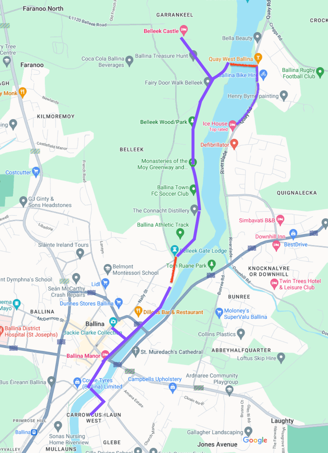
possible culture and entertainment trail stretching from St Michaels church to Belleek castle and the Quay (missing pieces in red)
Walking:
There are already multiple initiatives in train that are looking to enhance the towns historical connections, particularly the pathways, squares, riverbanks and laneways, for example the “Cascade” project led by UCD Centre for Irish Towns and ACT architects.
Laneway impression, ACT studios
The accessability of the town for pedestrians has deteriorated as car ownership and heavy goods traffic has increased. Solutions to this and other problems such as access to the river have been identified in successive reports and surveys including the recently commissioned public realm study.
ballina public realm study maps showing opportunities for improvement

One of the fundamental aspirations for any town is to cultivate an environment where every inhabitant can cycle or walk to their desired destinations, free from the encumbrances and risks associated with private car traffic. This is merely returning towns like Ballina to the context of their design and nothing more than that. There is no need to market a concept such as the 15 minute city to describe a timeless function. The opposite is of course also true. If people become the subaltern in an urban space colonized by traffic, they will choose to live elsewhere.
By integrating walking and cycling routes and filling in the missing pieces where needed we’re not just facilitating mobility but reviving the town’s ethos, marrying modern concepts of sustainability, health, and community welfare with the timeless activities of walking to school, to work, to nature or to a social gathering.
Local Public Transport
Ballina and its satellite towns, intertwined by history, culture, and commerce, deserve a transportation network that embodies these values. An integrated train, bus and minibus network is eminently feasible and requires nothing more than political will and cooperation, to fill network gaps and co-ordinate new and existing services.
An Integrated Network
A glance at the proposed network centred on Ballina and its feeder towns showcases a web of connections that bridge urban with suburban, central hubs with recreational areas, and key destinations with residential zones.

This design aspires to offer residents and visitors efficient, consistent, and accessible transit options, covering the breadth and width of the region.
Drawing Inspiration from the Algarve
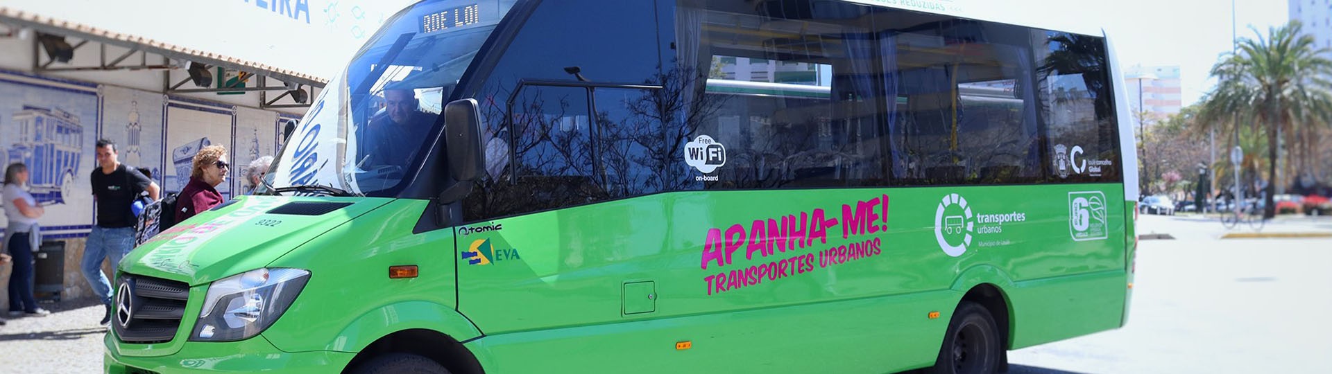
The Loulé region of the Algarve, a destination familiar to many residents of the region who fly there each year from Knock airport, has pioneered an ecological minibus service model that operates in a comparable demographic and topography.
The service specifications from Loulé can be accessed here. There are five operational lines, with the longer ones spanning distances comparable to those between Ballina and its surrounding towns. Notable feature of the service include:
- cheap cost (1 euro fare)
- modern (wifi, smartphone app)
- ecologically friendly (Euro IV emissions rating)
- frequent (every 30 minutes)
- interconnectivity - centers around the local railway station offering connections for longer journeys in the region.
Local link services in Mayo have a very similar function to the urban minibus network proposed here, it is merely a question of the scope and ambition involved in service provision.
Local link could and should be used to implement an initial local transport system for the Ballina area until TII are willing to do so. To be successful the key precepts of the Algarve service must be adopted:
- frequency
- low cost
- connectivity
It should be noted that the Connecting Ireland Plan mandates local bus services for towns over 10,000 in population which qualifies Ballina in any case.
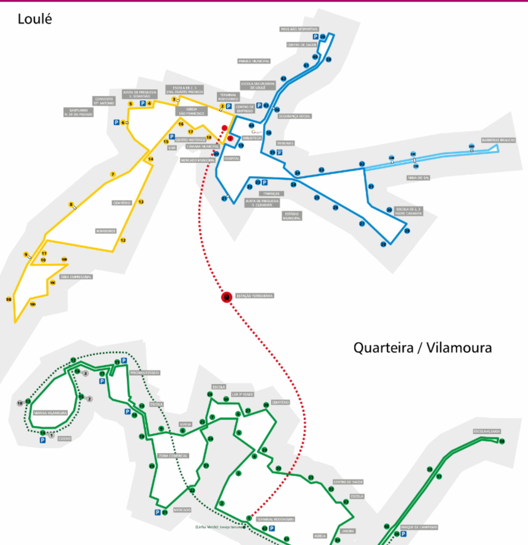
A map of current local link services in Ballina area
Local Rail Services
The railway system, since its inception, has always been a symbol of progress, development, and connectivity. Despite many attempts to close it, the railway has endured in north Mayo and the challenge now is to leverage it to foster deeper connections between towns and enhance the mobility of residents.
Rails services in Mayo, taken from “Maytro” proposal

Foxford and Ballina already have a very good railway service it must be said, offering frequencies of approximately 2 services per hour (2ph) during peak times and 3 services per hour (3ph) during off-peak times.
Upcoming timetable changes will increase the frequency further. By restoring a single service cancelled in 2010 during austerity and tightening up the timetable viz. connections to Westport train frequency could be ramped up to 1 service per hour (1ph) during peak times and 2 services per hour (2ph) during off-peak times.
This increase would not only provide and excellent and fast local transport link between Ballina and Foxford, the most southerly satellite town with Ballina’s orbit, but also Castlebar, the county town and a centre for many important regional services.
comparison of services between Ballina and Foxford showing current and potential service given better implementation see this article for more details
| Timetable | From | To | Trains | Duration | Per hour | First | Last |
|---|---|---|---|---|---|---|---|
| Current | Ballina | Foxford | 8 | 11 | 1.9 | 05:05 | 20:32 |
| Current | Foxford | Ballina | 8 | 13 | 1.9 | 05:52 | 21:19 |
| Optimised | Ballina | Foxford | 12 | 11 | 1.4 | 05:05 | 22:02 |
| Optimised | Foxford | Ballina | 12 | 13 | 1.4 | 05:52 | 22:44 |
Connectivity and service levels
Ireland’s public transport system is challenging to use as bus and rail services are not integrated and are generally very infrequent.
The scenario is Ballina is atypical thankfully, as the rail service level is quite good. As the local bus service would be run by Mayo County Council through the local link franchise system, an integrated rail timetable could be implemented without needing to coordinate between different transport companies.
Having said that, Mayo County Council should have a permanent arrangement to constantly liaise with the National Transport Companies regarding service levels and crucially pricing. The goal of public transport provision is to provide the greatest social benefit, not to produce paper profit. Pricing should be flexible enough to achieve this goal.
Roads
The concept of an orbital bypass road for Ballina is neither new nor unfamiliar. Historically, various specifications and plans have been proposed since at least the 1980s to alleviate traffic congestion, redirect freight traffic, and ensure the historical town centre retains its unique charm. It is essential, however, that any future decisions align with the broader vision of sustainable, multi-modal urban development.
The original plans for the orbital bypass road are archived here. More recent developments can be perused on the Mayo County Council’s website.
Legacy blueprint for the bypass including missing Killala road connector
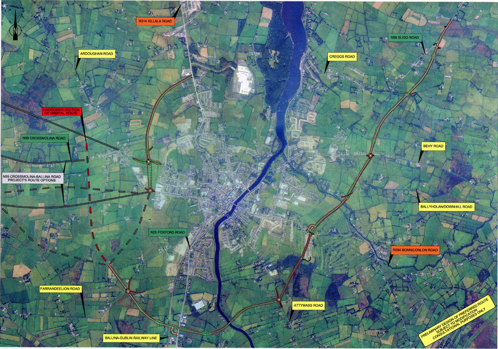
Current map available from the mayo county council roads page
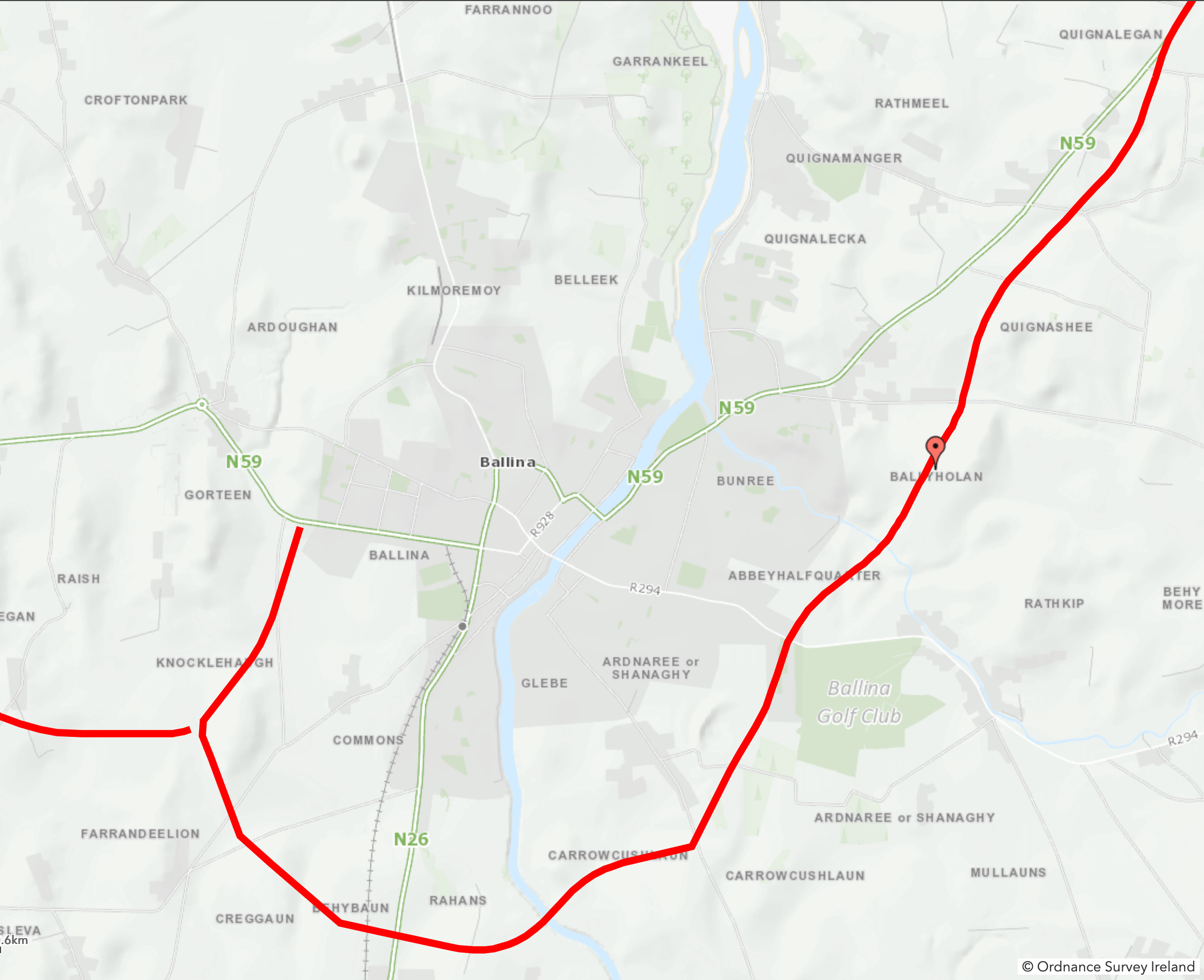
Although TII is building the short section between the Foxford and Crossmolina roads, of concern is the absence of a scheduled construction timeline for the eastern bypass. This crucial section would permit traffic from Sligo to access the Foxford road without meandering through the historical town centre.
Future-Proofing
Thinking ahead, it’s prudent to include reservations for future rail sidings along bypass roads to the east and west. Rails sidings are cheap, low-spec lines designed to connect Industrial sites with the rail network. A rough construction cost per km would be approximately 15% of an equivalent road. Even if these sidings aren’t immediately utilized, their inclusion can offer interim benefits as pedestrian paths, cycling routes, or even nature walks. These provisions could drastically reduce truck movements to the town’s freight yard in the future. The importance of diminishing heavy truck traffic in urban areas cannot be understated. It enhances safety, air quality, and overall quality of life for residents and reduces damage to roads.
Coca-cola’s current use of rail-freight exemplifies the efficiency of this mode of transport, especially when considering direct port access over multi-modal solutions. Furthermore, potential future projects, such as the liquid gas terminal proposal to the East or ambitious renewable energy projects in the West may hinge on rail-freight access to ports for their feasibility. Whether by road or rail the existence of an orbital route will increase the viability of these projects greatly which otherwise may run into planning difficulties due to the increase in heavy goods movements through the town.
Map showing industrial locations in relation to heavy freight corridors.

Balancing Specifications with Sustainable Goals
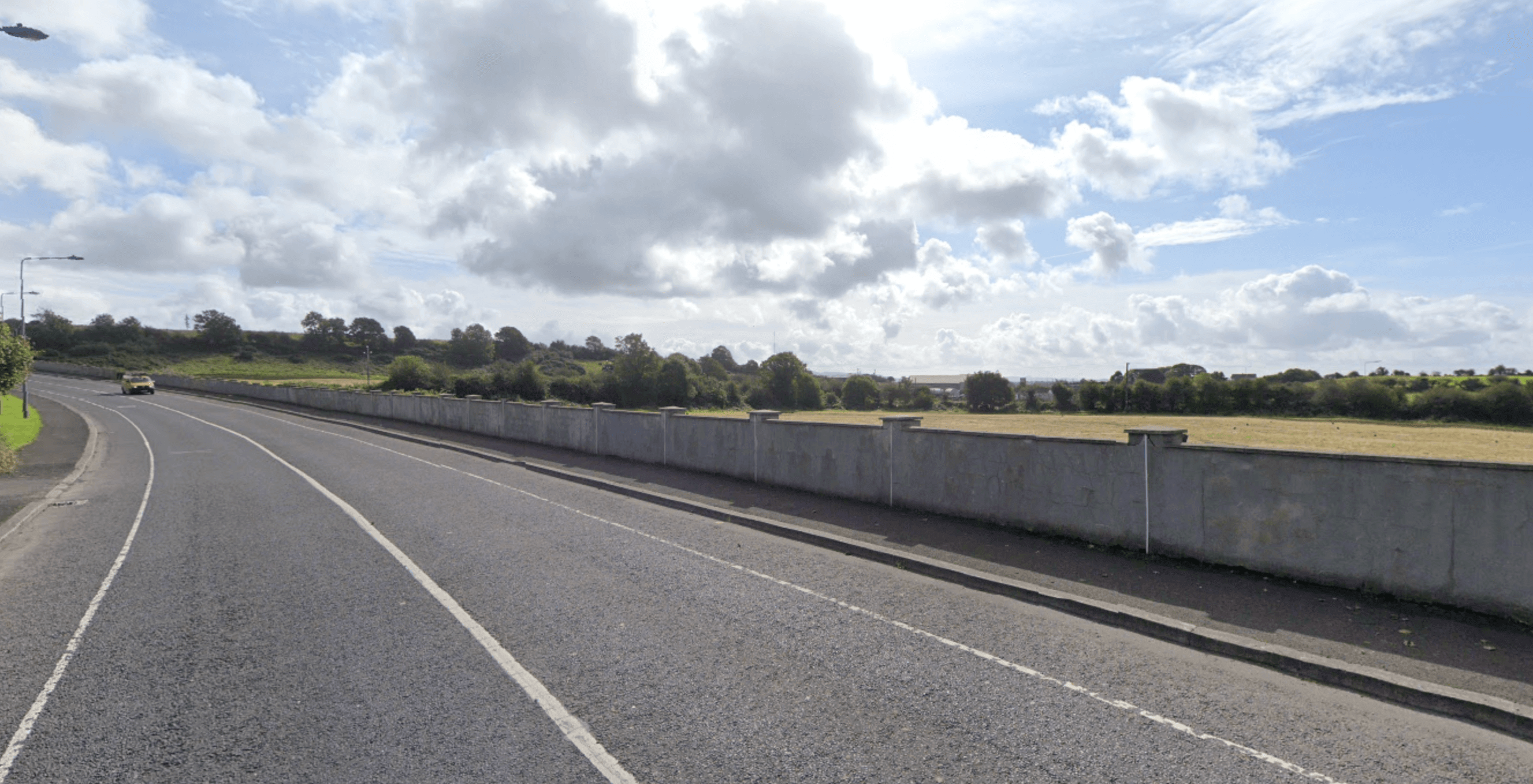
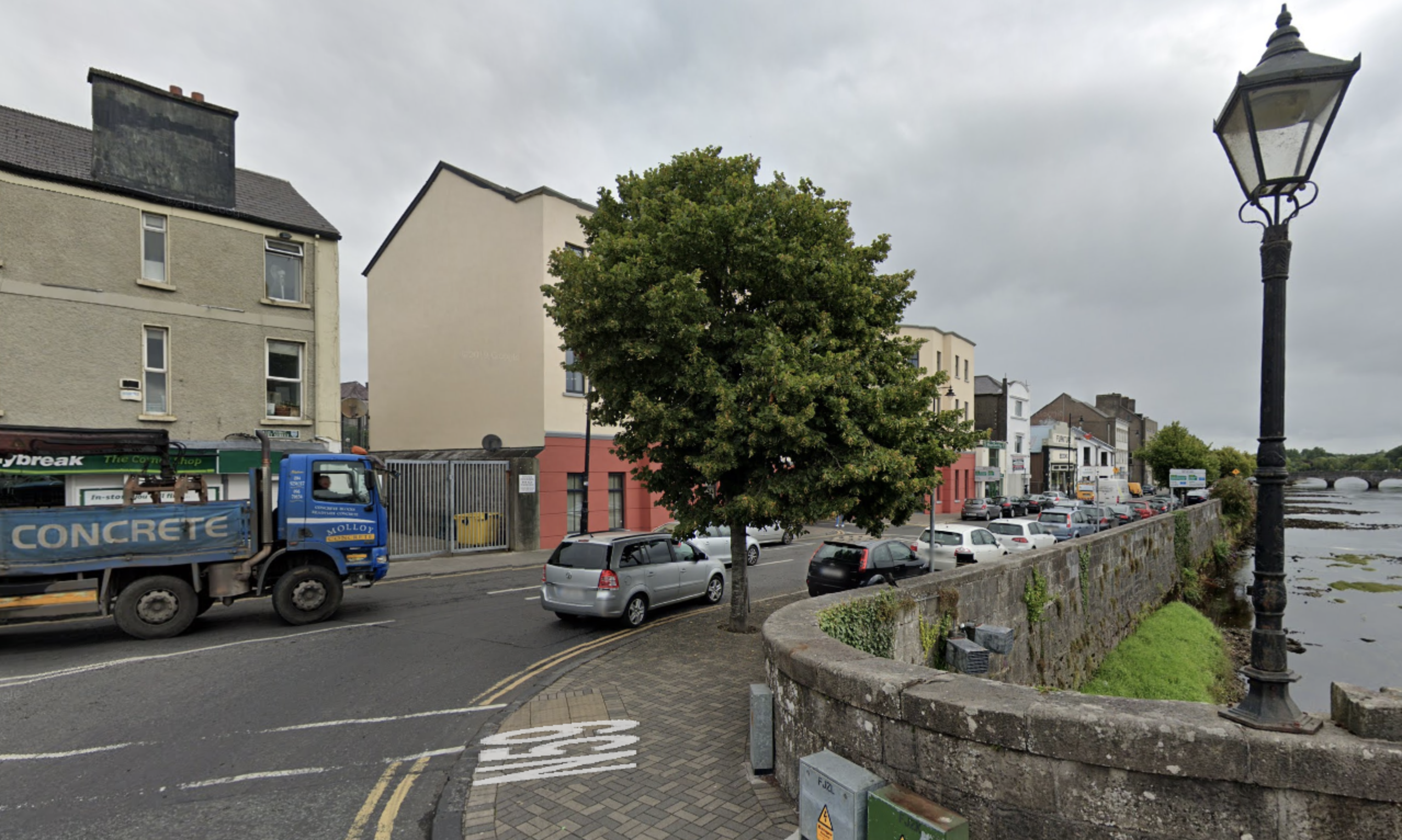
Transport Infrastructure Ireland tends towards over-specifying road projects, for example the Westport-Castlebar or Limerick-Cork schemes, leaving Ireland with expensive, white elephant motorways. “Build it and they will come” is not a mantra appropriate to Ireland’s environmental commitments regarding the private car. An alternative, modern approach is required to road building. The council’s successful execution of a 1.5km regional road connecting the Killala road with the Crossmolina road exemplifies that more pragmatic solutions are within reach.
Regional road constructed by Mayo County Council in Ballina urban area
Given that regional roads can support speeds up to 100 kmph and even expand into dual carriageways when justified, the eastern part of the orbital route could commence as a regional road and undergo future upgrades as necessary. In fact it’s questionable if this stretch of road needs be specified as a primary or secondary route at all. Its main function is to divert goods and private traffic away from the historical centre of the town and the riverside, not to provide a primary trunk route for fast moving traffic.
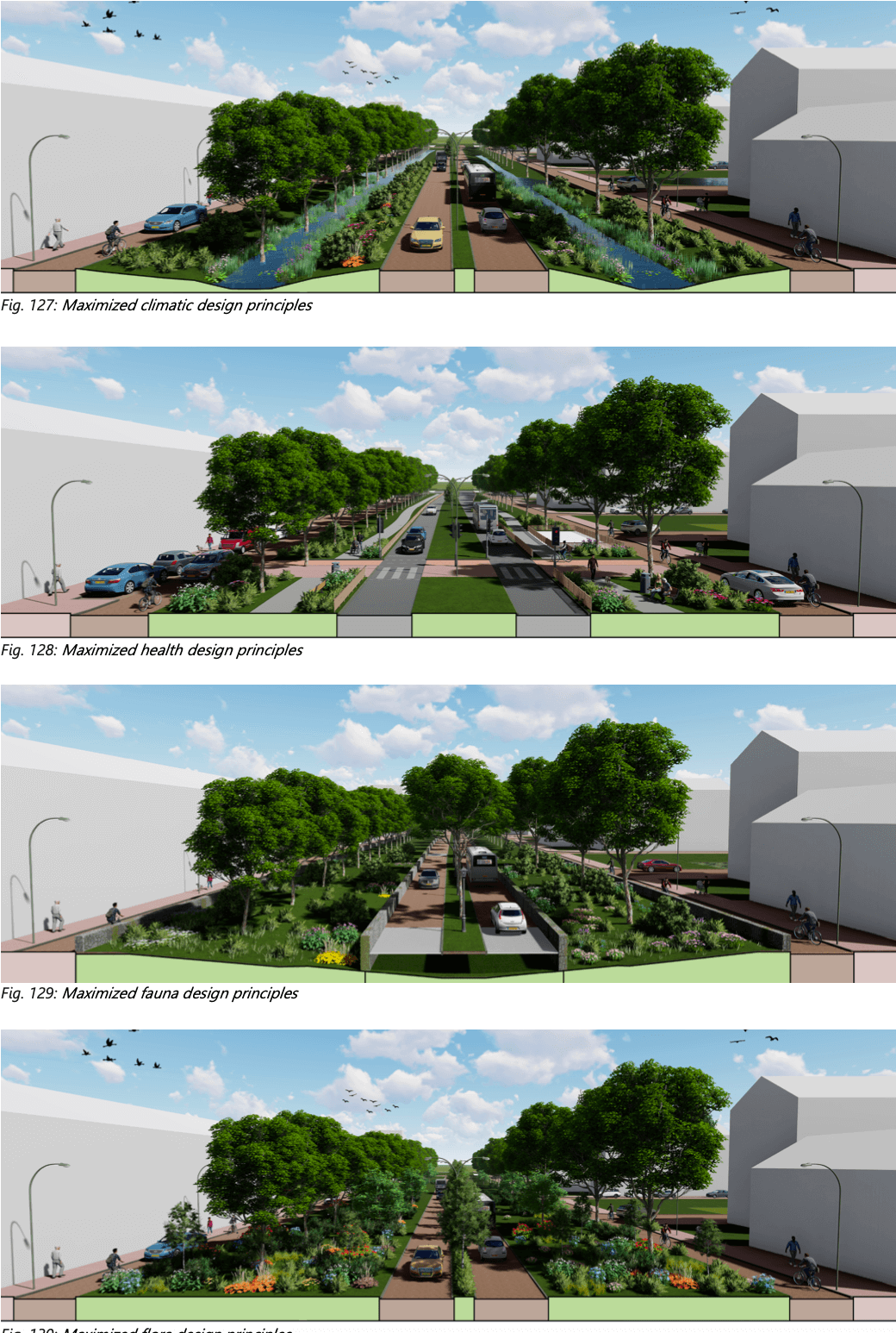
Green Design for Bypass Roads:
New roads as specified today, are a brutal imposition on the urban, suburban and open countryside. They divide communities, create noise and disturbance, are dangerous for drivers and pedestrians, are expensive to maintain, increase carbon emissions, consume huge swathes of agricultural land and offer a truly violent, jarring break from a unified urban or bucolic landscape. Despite this, sometimes thoughtfully constructed new roads are necessary and can bring benefits that outweigh these significant drawbacks, as is the case in Ballina.
Modern bypass roads must incorporate green designs, ensuring they blend seamlessly with the natural environment. Green barriers can act as buffers, protecting surrounding homes and landscapes from noise and visual pollution. Additionally, by integrating pathways for walking and cycling, these bypass roads can serve a dual purpose, promoting active transport and leisurely recreation.
Rather than constructing dominant, speed-centric road structures, therefore the bypass should emphasize a green, multi-modal design. This approach harmonizes with the overarching goals of reducing carbon footprints, promoting alternative transport modes, and preserving the urban charm.
examples of multi-modal green road constuction from the Netherlands. Note green barrier protection to surrounds and cycle, walk, auxiliary pathways
The council can complete the missing sections of the orbital road as a regional road. One of the many benefits of this is it will allow heavy goods traffic to bypass the town, benefiting both the company and the town’s residents. Arguably given the weight of existing traffic and Ireland sustainable goals, a lower spec road is both desirable and appropriate.
A bypass, not an access road.
It’s important to note that a key aspect to the success of any orbital route it to forbid rezoning around it and access to non-through traffic. If this is not strictly observed the road will soon be clogged by local traffic, rendering it useless for the purpose that it was originally built for, a common anti-pattern to be observed in places like Sligo, Galway and Dublin amongst others, resulting in calls for a further bypass. Meanwhile ugly, depressing buildings disfigure the urban area, resulting in a lose-lose-lose scenario. The compact historical town is swamped by poor development, strangling it of life, the bypass ceases to function as local traffic plugs it up and finally the money and effort expended building it is wasted and duplicated as another bypass must be built to bypass the bypass. The disastrous example of Castlebar should be instructive in this regard, it is important that Ballina learns from the mistakes of its neighbor.
In summary, completing the orbital bypass road is an essential part of Ballina’s transport solution. It can be built by both TII and the council working in parallel to appropriate specifications. It is crucial however that its execution aligns with modern sustainability goals, placing Ballina’s urban well-being at the forefront before the needs of the private car.
The River
Ballina’s relationship with the River Moy is deeply interwoven into its history and culture. At the moment the urban population is alienated from the river by a uncompromising traffic system that circumnavigates its urban shores. Resetting the relation of the town and it’s most majestic feature, the river, can become more than just a aesthetic improvement - it can transform into an artery for sustainable transportation, recreation, and cultural connection. Here’s a holistic vision for the river:
Closing Emmet Street to through traffic to improve safety and urban life in general:
The current one way system in Ballina requires traffic (private cars and LGVs) merging on either river bridge to weave to the opposite lane over an extremely short stretch (~69 meters). This is incredibly dangerous for obvious reasons. It’s hard to see how such a complicated and pressurized maneuver would comply with proper road driving rules, regulations and safety requirements.
Indeed even though the intention is to achieve a free flow merge, many cautious drivers yield instinctively to the other lane to try and get their bearings which introduces other complications for drivers who observe the esoteric free flow signage. Adding ever more complexity are the traffic islands with painted pedestrian paths that have no clear right of way indicated, motorist or pedestrian. It seems to be up to the largesse of the driver whether to yield or not, again contradicting the intention of free flow.
Point “A” is the most dangerous, just 70 meters to change lane and the main heavy goods route (Sligo-Foxford) must change lane. At “B” the majority of traffic from both directions changes lane. Closing Emmet street eliminates “B” and make “A” a unidirectional merge. “A” could be eliminated altogether by making Ardnaree traffic yield to Sligo, which many drivers already do.
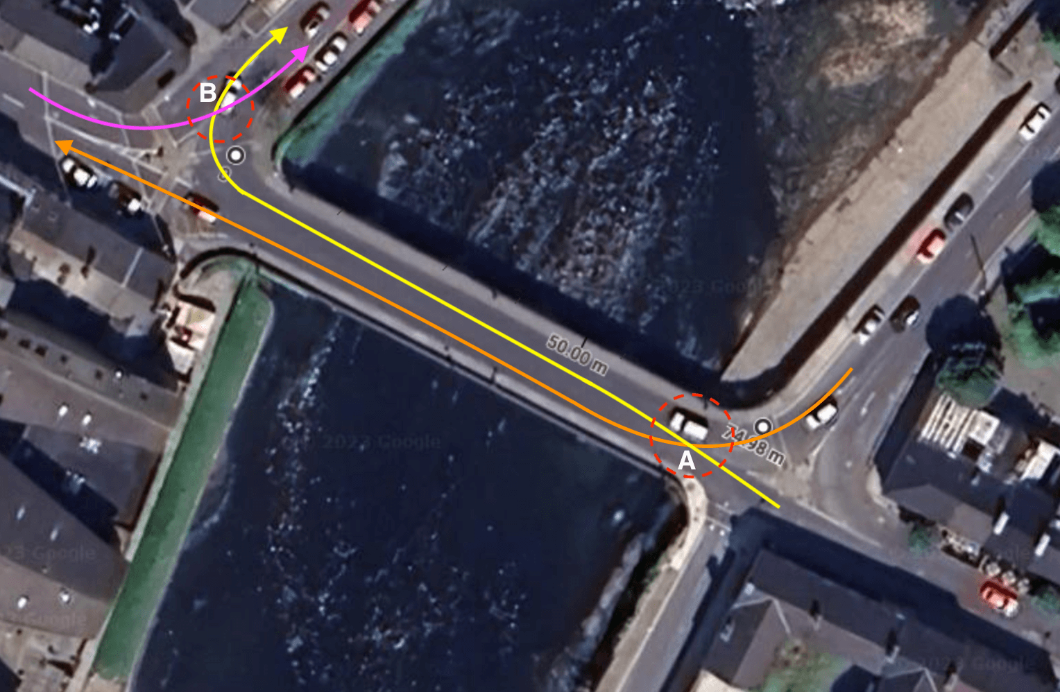
Closing Emmet street to through traffic would eliminate the bi-directional weave and extending the length available to merge traffic. There is no absolute need for through traffic to travel down Emmet street as all its possible routes are duplicated and can be diverted:
- From Ardnaree to Sligo, use Bunree.
- From Foxford road to Sligo, use circular road.
- From town centre via Bridge street, use Market road or Pearse Street exits.
An added benefit of the closure will be the removal of through traffic taking a ‘short-cut’ through the town centre.
The western shore of the Moy (the ‘town’ side), should prioritize pedestrian movements. Local access for parking and deliveries can be maintained, but the through-flow of private vehicles removed. This opens opportunities to widen pavements, add cycling lanes, plant trees, install public seating. The river’s edge can become a vibrant public space where people naturally congregate to enjoy themselves.
A bouleplatz by the Landwehrkanal, a waterside road thoroughfare partly reclaimed for recreation, given Ballina’s French connection, not entirely out of place!
Solutions like barriers, traffic calming measures, or full pedestrianization (similar to the interventions on Pearse Street) can transform this area into a bustling, community-friendly space. These arrangement have already been trialed several times, most recently for the Biden visit without incident and indeed councilors have called for a more permanent solution.
Emmet street today, fast moving traffic merges from both sides, town cut off from river.
A vibrant, pedestrian friendly riverbank connected to the town.

Crossing from Belleek to the Quay
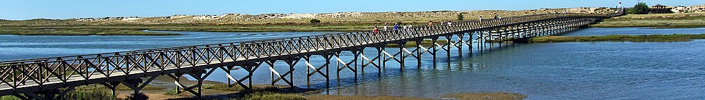
The many benefits of establishing more pedestrian and cyclist-friendly crossings at various points between the town centre and the Quay have already been discussed, as have the potential locations for new crossings. Building a pedestrian bridge across the Moy should present no major engineering problem for Mayo County Council nor should it be prohibitively expensive, especially where the river is shallower between Riverslade and Quignalecka.
Drawing inspiration again from the Algarve, the long wooden bridge at Quinta do Lago.
Further down the Quay the shipping channel is wider which may require a different approach. Apart from traditional bridge building methods, there are many other old and modern solutions that can be used to provide access across the Moy:
- Modular Pedestrian and cycle bridges are a cost effective option that can be installed quickly without heavy machinery.
- Autonomous watercraft are an new technology being deployed in European cities.
- Cable current ferries, common in Germany, use natural currents for propulsion.
- Bike Ferries are common on European cycle routes allowing cyclists across water bodies.
- Chain Ferries: Human-powered or mechanically driven, chain ferries like the ones detailed here can be a sustainable river crossing option.
A cable current ferry in Germany
A bike ferry in holland

It’s strange give our proximity to water at all times and our heritage of small rowboats in Mayo that the river and estuary doesn’t play a bigger part moving people around Ballina. We can perhaps borrow some inspiration from our neighbours in Europe, where river transport is integrated into daily life, sometimes in surprising and creative ways!
Taking Action
Conclusion
Reflecting on the multi-modal transport picture of Ballina today and indeed thinking about what it might become in the future, one is struck by how eminently realizable it is. Many pieces of a well-functioning overall system are already in place. There are a few missing links, most notably the orbital road.
The council is to be commended on many of the initiatives it has carried out or is in the process of carrying out, such as successfully campaigning to preserve rail access to the town, improvements to Pearse Street, the military barracks renovation, and new paths and cycleways along the Moy, including the pedestrian bridge.
Now is the right time to launch a public campaign and petition to help the council identify priorities and gain support for the next phase of projects from central Government. It will also help to inform the current minister of transport of the opportunities here to pilot innovative sustainable transport solutions away from the dominant urban centres.
Recommendations
- Orbital Road: Even if Transport Infrastructure Ireland is reluctant to undertake the orbital bypass as a national project, Mayo County Council can deliver it as a regional road, aligning it with the community’s needs. It can be completed in phases and upgraded to a national route later if required.
- Local Public Transport: Instead of waiting for new infrastructure, optimize and expand existing networks. This includes maximizing the local-link franchise system for bus services and addressing gaps in cycling and walking pathways.
- Bridge the Moy with Innovative Solutions: If traditional bridge funding is unattainable, explore alternative water crossings, from autonomous watercraft to bike ferries, ensuring connectivity and enhancing the town’s appeal.
- Pilot Traffic Reforms: Ballina should not hesitate to trial progressive traffic measures. These pilot programs can serve as templates, providing invaluable insights for long-term strategies. They can be retained, tweaked, or expanded based on community feedback.
- Green Public Spaces: Use contemporary innovations to balance the needs of the private car with the needs of the citizens and mitigate the bleakness that surface car parking inflicts on urban spaces.
- Advocate for Enhanced Rail Services: Liaise with Irish Rail regularly, assume responsibility for promotion, drive service change from the bottom up.
- Make Public Transport Frequent and Cheap: Run enough services and find a way to subsidize them or better yet make them free.
- Implement Cycling Plan Make it possible for all locations in the town to be reachable with 10 minutes on safe cycle lanes and paths.
- Connect everything: Buses and trains, bikes and pedestrians, the town center and outskirts. Make it easy for people to get around without a car.
Sources and further reading
- Ireland’s Greenest Town Initiative - ACT Studio.
- Cycling network around Ballina - Cian Ginty.
- Ballina Orbital Road Plans - Mayo County Council.
- Maytró - Mayo local Public Transport Seosamh Ó Cathail.